By the beginning of September, I was finishing all the work on the balloon. I had already begun surveying the wind conditions. because the upcoming fall meant a danger of stronger winds than I would desire. One window of possible launch days began to materialize around September 15-17. This is the development of predicted landing sites for September 15 and 16.
On Sunday the 14th, I decided that the launch day would be on Tuesday the 16th. That turned out to be a good choice, because on Monday I woke up into an impenetrable fog. In Monday evening, I prepared everything I would need the next day and used the Landing Predictor for a set of tomorrow's possible trajectories.
The following morning, I made the last predictions. The landing sites moved a little bit but remained in my desired zone.
The weather outside looked much more suitable than the previous day, so I put everything into a car and set off to the launch site.
This was the launch site. The wind would take the balloon to the left of the two chimneys in the distance. But first, I had to fill the balloon.
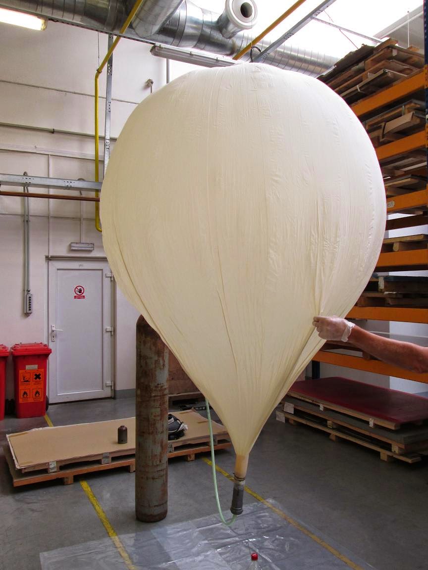
It is good to put some underlay underneath the balloon, so it doesn't get pierced by anything sharp. Also, it is good to have a look at the throttle-valve ahead and make sure you can securely attach your filling instrument to it. In my case, I just slipped the hose on and tightened it with a fastener. It is advisable to handle the balloon in latex gloves as well.
On the other end, I secured the balloon to the filling tube with a pair of plastic fasteners and some tape.
Due to the throttle-valve, the filling to the appropriate volume took more than an hour. Something I didn't count with, so instead of the intended 9AM launch, the balloon lifted off shortly after 10AM.
When the helium inside the balloon began to lift the weight and the set hovered, I knew I had the necessary lift. Earlier, I calculated the neck lift to 1396g giving me 456g of free lift. The gross lift of the helium inside the balloon then was 2196g. To seal the balloon, I used another pair of plastic fasteners, a string and a lot of electric tape to hide the sharp edges of the fasteners. After detaching the filling tube, I folded the balloon ending, laced through the cord going to the parachute and secured it with more fasteners, string and tape.
Then it was time to relocate outside.
I set up the receiving 'station' consisting of the antenna, my notebook and the SDR. I used my phone to create a Wi-Fi hotspot.
After that, I turned on the GPS and verified the lock and the reception. It all worked fine. The only problem was caused either by the excruciatingly slow notebook or the terrible internet connection, but I simply couldn't load the Habitat website and verify that my balloon was visible there. Luckily, that was solved by my friend's phone call a little later. At that moment, I reread my checklist because it was time to turn on the camera script and then finish the payload sealing as quickly as possible.
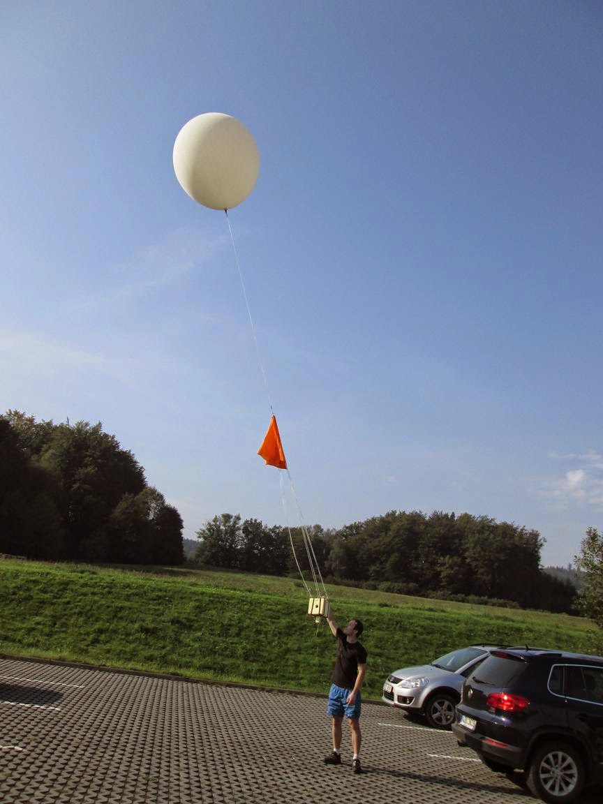
Once done, a couple of poses for the camera followed, and then finally, the months of preparations were out of my hands. The balloon ascended quickly, perhaps too quickly, because the altitude data showed a vertical speed of about 5m/s as opposed to the expected 3.48m/s.
I traced the payload to about 11km of altitude and then set off for a better located lookout.
At the spot, I was unpleasantly surprised by the low clouds surrounding the whole hill. Originally, one could oversee the whole area from this location, but due to the poor visibility, the only connection with the balloon was the radio
I caught up with the balloon shortly after it surpassed 20km in altitude still rising about those 5m/s and with exactly the same trajectory as predicted.
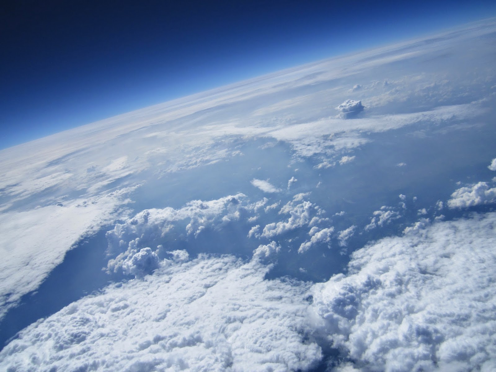
And then it finally came. The telemetry from 30km in altitude printed out on the screen, and the goal was achieved. Now, I was waiting only for the burst. But the balloon passed 31km, then it past the predicted 31484m, then 32km, then 33km, the 34km. At that time, my eyes were fixed on every new telemetry string enjoying every additional meter. And then finally at 34396 meters, the ascent stopped.

As the balloon began its fall, two things happened. Firstly, I realized that the balloon was slowing down too much. I expected the descent speed at ground to be about 5m/s, but with still 15km remaining, it was already below 5m/s. That meant that the landing site would be further to the west. Another unpleasant consequence was that it would take much longer for the balloon to land. The original expectation was 2.5 hour to ascend and 45 minutes long descent. But after an hour, the balloon had still more than 7km to go with the speed then being 3m/s. My notebook, though being one of those intended to function quite long, was slowly running out of battery. I had to start saving power by periodically turning off the reception, and I decided to relocate further to the west.

After I set up the reception apparatus, I found out that I had about 5 minutes of power remaining. To pile on the bad news, despite the less than ideal internet connection, I managed to display the balloon's current position on a map and found out it was much much further than I would like it to be, heading to a fairly forested and hilly area. The short disbelief was then interrupted by the notebook finally giving up leaving me with the last piece of information that said the balloon was still at about 750 meters in altitude and heading further to to me unknown terrain. With that in mind, I turned back and headed home to recharge the notebook and come up with a plan.

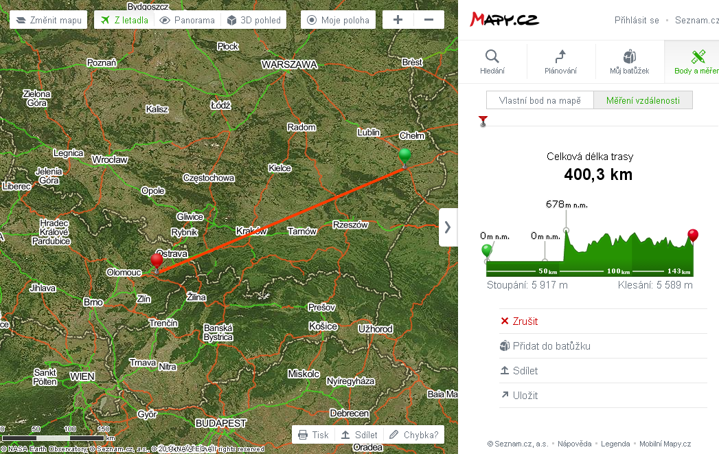
At home, I turned on my PC and found out that many more people were receiving and uploading the balloon's telemetry, so the trajectory was mapped completely. The last telemetry string was received from 713 meters right above a small village called Jindrichov. I was really glad to see long rows of fields on the map when I switched to the satellite view. The last known position is circled in the picture above. The last shown position was added after I arrived at the spot. At that time, I knew that the balloon had about 250 meters yet to fall and that the descent speed was 2m/s. Based on the horizontal speed, I calculated that the balloon should be within 600 meters from the last known position. That area covered only fields and the village, so I was quite confident about finding it. Moreover, after driving through the village in Google Street View, I could see that the road led through a bottom of a valley and the fields were rising up a hill on both sides. That meant that I could easily find a higher ground and possibly see the payload directly. Thus I set off.

After less than an hour, I was driving through the village looking for a side road leading to a higher ground that I had seen on the map. I took a friend on this journey, and as we were climbing the hill, he noticed something orange lying on the opposite side of the village. I stopped the car, took out a pair of binoculars and saw that it really was my payload lying in a field about two hundred meters from the road. Just to make sure and to upload the last coordinate, I took out the antenna and notebook to do the job.
Then I just drove down to the village and stopped as close to the spot as possible. The field was right behind a couple of houses.
On the way for the payload, I scared a herd of sheep that rather relocated higher up the field.
And there was the payload. Everything that left in the morning was still attached. Only the balloon was ruptured and the antenna due to the impact bent.
After opening the payload, I was more then pleased to see that the photos and videos were all on the SD card. Based on the number of them, the camera managed to function the whole tested time, 2 hours and 41 minutes. The transmitter was still transmitting and the datalogger measuring.
All in all a great day and a cool experience. Time to go home.


.png)


.PNG)


.png)
.png)
.png)
.png)
.png)
.png)
.png)
.png)